
Design Diary 3. Spittle-Fields
Part 3 of 8. Read part 1 2 4 5 6 7 8.
Spittle-Fields is a fantasy reimagining of Spitalfields, a district in the London Borough of Tower Hamlets. The name first appeared in the 12th century, when St. Mary Spital was founded as a priory and hospital to minister to the poor, sick and infirm (“spital” being a corruption of “hospital”).
In the 19th century, Mary Kelly lived and died in Spitalfields. A hundred years later, Iain Sinclair worked there as a gardener. In the 1990s, more than 10,000 bodies were exhumed from a mass grave on the site of Spitalfields Market.
Return of the Ripper freely combines historical elements from the Elizabethan era through the Victorian era, to create a deliberately anachronistic imaginary city. London: The Biography (Peter Ackroyd, 2000) supplied anecdotal details and historical texture.
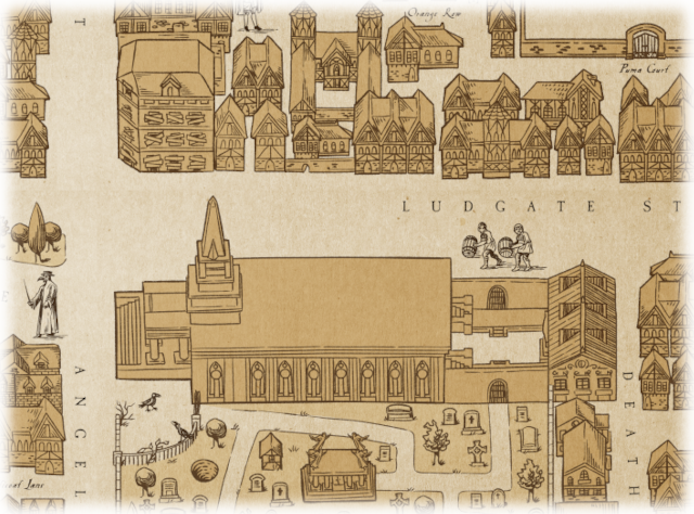
The aesthetic of the Spittle-Fields maps is inspired by the 16th-century “Agas” woodcut map of London1, which shows the area as The spitel Fyeld, outside the city wall and beyond the Busshoppes Gate (Bishopsgate).
The street plans and position of major landmarks are loosely based on 19th-century maps of Spitalfields; many locations use actual street and place names from that era. My research brought me back to the extant Victorian-era landmarks: Spitalfields Market, The Ten Bells, Christ Church Spitalfields.
Another inspirational oddity is Denis Severs’ House2. Severs refurbished and furnished the ten rooms of his home as dioramas of life in Spitalfields in the 18th–19th centuries. Peter Ackroyd describes a journey through the house as:
…a journey through time; with its small rooms and hidden corridors, its whispered asides and sudden revelations, it resembles a pilgrimage through life itself.
This post is an excerpt from Return of the Ripper Appendix N: Inspirational Sources.
Part 3 of 8. Read part
1
2
4
5
6 7 8.
Notes
1. The Map of Early Modern London, Civitas Londinum, is a bird's-eye view of London first printed from woodblocks in about 1561. Widely known as the Agas map because of a spurious attribution to surveyor Ralph Agas (c.1540–1621). The original is stored in the London Metropolitan Archive.
2. Denis Severs' House. 18 Folgate Street, London.